Polar Pathways: Robert E. Peary's Arctic Expeditions

1905-1906: Seeking the Pole
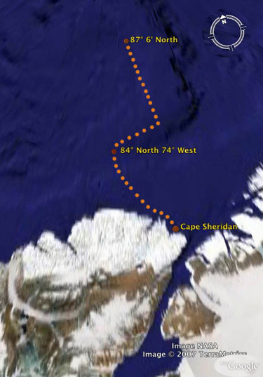
Peary's sledge trips across the Inland ice and other areas of Greenland were not as carefully chronicled as his ship passages to and from Greenland; the maps, and Peary's accounts of his routes, lack exact precision. However, Peary did keep detailed journals about his trek across the arctic terrain. While his narratives lack an abundance of coordinates, they provide readers with a frosty and thrilling account of Peary's struggles on the "Great Ice." The routes provided are taken from Peary's own cartography and provide a reasonable estimate of the trek. Click a location, description or date to learn more about that moment in time.
 1906 Map (you are here)
Point Moss: Brilliant Moonlight
Polar Ice Pack: Tea on the Ice
84 N 74 W: Timely Observations
Departure from 87 N: Red-Hot Needles
Greenland Mountain: Land Clouds