Polar Pathways: Robert E. Peary's Arctic Expeditions

1902- 84 North: The Game Is Off
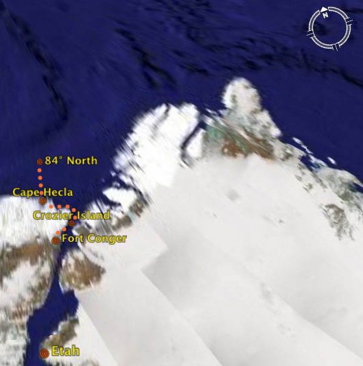
Map of Fort Conger to 84 North
“A clear day enabled me to get my observation which
showed my latitude to be 84 17 27 N., magnetic variation 99 West. I took
some photographs of the camp, climbed and floundered through the broken
fragments and waist-deep snow for a few hundred yards north of the camp,
gave the dogs a double ration, then turned in to sleep, if possible, for
a few hours preparatory to returning… We
started on our return soon after midnight of [April] 21st.” - Robert
E. Peary in Nearest the Pole, published in 1907
The following is taken from one of Peary's journal entries:
“April 21st.— The game is off. My dream of sixteen years ended. It cleared during the night and we got underway this morning. Deep snow. Two small old floes. Then came another region of old rubble and deep snow. A survey from the top of a pinnacle showed this extending north, east and west, as far as could be seen. The two old floes, over which we had just come, are the only ones in sight. It is impracticable and I gave the order to camp. I have made the best fight I knew. I believe it has been a good one. But I cannot accomplish the impossible.”
"Map of Fort Conger to 84 North" by TerraMetrics, 2007, Google Earth