Merrymeeting Bay / Kennebec Estuary Research Program (Bowdoin)

Overview

The Environmental Studies Program and Institute for Coastal Studies at Bowdoin College have begun a long-term ecology and environmental science study in the mid-coast region of Maine. The Kennebec estuary is an important source of freshwater, nutrients, and pollution to Casco Bay and has been implicated in the harmful "redtide" algal blooms that periodically close the shellfish industry up and down the coast. Merrymeeting Bay is the upper, freshwater portion of the Kennebec estuary, which receives water from two of Maine largest rivers, the Kennebec and the Androscoggin. The combined watershed area makes it the second largest river emptying into the Gulf of Maine after the Penobscot River. The research project is bringing together students and faculty in Biology, Earth & Oceanographic Science, Chemistry, History, and Anthropology.
Merrymeeting Bay is formed by the confluence of six rivers: the Kennebec, Androscoggin, Muddy, Cathance, Abagadasset, and Eastern, 30 km inland from the mouth of the Kennebec (see maps). At one time, Merrymeeting Bay and its tributaries supported prodigious numbers of migrating anadromous fish and waterfowl. However, overfishing, land clearance, dams, and most notably severe water pollution degraded the ecosystem during the 19th and 20th centuries. Today, the anadromous fish runs are but vestiges of their former abundance, the sediments and biota remain contaminated with industrial wastes, and the water is turbid with high algal productivity resulting from excessive nutrient inputs from industry, municipalities, and atmospheric deposition.

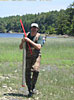
Our research seeks to understand the ecological processes at work in the estuary today as well as the legacies of its checkered past to provide information vital for better management and conservation. To this end, we have begun observational, experimental, and retrospective studies that describe ecological and geological patterns and test hypotheses about the mechanisms underlying those patterns. Retrospective studies describe patterns backward through time to provide information about natural baseline conditions prior to the influence of land clearance and industrialization. For example, we have initiated a long-term monitoring study of the inputs and processing of important chemicals such as carbon, nitrogen, phosphorus, and silica in the estuary. Additional experiments will determine the relative importance of nitrogen and phosphorus as limiting nutrients, and test whether or not phosphorus contained in sediments interacts with the water column. If so, phosphorus pollution of the past may still haunt the ecosystem. We are also experimenting with nutrient removal to predict how further clean up of the rivers might influence the ecosystem. Other ongoing studies include work with electronic instruments to understand patterns of hydrological flow and mixing within the estuary, an annual census of emergent plant communities, a radio-tracking study of the movements of snapping turtles, new work describing the spawning and nursery habitat of anadromous fish within the upper estuary, and geological, biological, and chemical analyses of sediment cores collected throughout the estuary for reconstructing the environmental history of the ecosystem. Bowdoin students with help from faculty and staff conduct most of this research.
Participating Courses
ES 101: Introduction to Environmental Studies
Geology 100: Environmental Geology and Hydrology
Biology 105: Investigations in Biology
Biology/ES 225: Community and Ecosystem Ecology
ES 201/Bio 158: Perspectives in Environmental Science
ES 202: Environmental Policy and Politics
ES/Bio 394: The Ecology and Environmental History of Merrymeeting Bay